
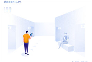
 Generally, GPS navigation is great… until you get to the front door. Then you’re lost. While we use satellites for outdoor navigation, they’re limited in indoor environments. Why? Because of a lack of line of sight. Fortunately, Bluetooth Low Energy (BLE), Wi-Fi, ultra-wideband (UWB), augmented reality (AR) and other technologies make indoor navigation possible.
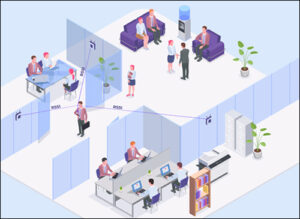
With the right navigation technology, you can optimize your working time using real-time door-to-door staff navigation, be quickly routed to any office or conference room, and can get location-based hints and notifications. Let’s explore some indoor navigation technologies suitable for office buildings. These will help you take the right route, whether you’re a long-serving staff member or a guest.

Source: Pixabay
What Is Wayfinding—and How Is It Different from Navigation?
Wayfinding is a broad term that includes all processes allowing you to discover your present location and the route you should follow to get to your destination. In buildings, it involves the use of signs, lighting, color, mobile applications and more. Navigation is a specific form of wayfinding that implies a precise knowledge of where you are, where you are going and how to get there. Navigation involves knowing where you are and moving to your destination.
Generally, navigation entails tracking your current position, planning feasible routes to your destination, and selecting and following a specific route to your desired destination. When navigation is in an indoor space, it’s called indoor navigation. Another term you will encounter is indoor positioning, which refers to pinpointing the location of a person, asset or room inside a building accurately. Several technologies play a role in helping people navigate offices and complex building structures.

Wi-Fi-Based Technologies
Most, if not all, office buildings are equipped with Wi-Fi, a wireless local area network (LAN) technology that uses the IEEE 802.11 standards for communications. Wi-Fi employs radio waves to transmit data from your device to an access point or a router. While office personnel mostly utilize Wi-Fi to connect to the Internet, it is also useful for indoor navigation. Specifically, two Wi-Fi technologies lead the way in office staff navigation: Wi-Fi positioning and Wi-Fi RTT.
 Wi-Fi Positioning
In Wi-Fi positioning, the indoor position of office staff members or guests is determined via the signal strength from different Wi-Fi access points. Here, an indoor navigation app is installed on personnel or guest mobile devices. Using received signal strength indication (RSSI) and media access control (MAD) addresses, a navigation app can calculate the location of each device.
However, since not everyone wants to install an app, another solution is to use mobile Wi-Fi tags, which people can wear. Each tag receives signals from multiple Wi-Fi access points, and its position is determined based on RSSI. The accuracy of Wi-Fi positioning ranges between 3 meters and 15 meters (9.8 feet and 49.2 feet). It depends on the number of obstructions and access points.
Okay, we’ve mentioned access points several times already, and you might wonder what an access point is. An access point is a wireless network device that extends the coverage of the network established by a Wi-Fi router. It is used to increase the number of people who can connect to a Wi-Fi network. It is important to note that while a Wi-Fi router can function as an access point, not all access points can work as routers.
Pros: No additional infrastructure is needed since Wi-Fi is widely available in most office buildings. And all smartphones are Wi-Fi-enabled, making the technology easily useable.
Cons: Wi-Fi drains device batteries quickly. Wi-Fi routers may be expensive to install. Wi-Fi tags are more expensive and less energy-efficient compared to Bluetooth beacons. And Wi-Fi positioning doesn’t work on Apple devices due to privacy restrictions, though this can be overcome by using Bluetooth beacons.
Wi-Fi RTT (Round-Trip Time)
This Wi-Fi-based technology measures the distance between a mobile device and Wi-Fi routers. Wi-Fi RTT (round-trip time) uses the Wi-Fi signal’s time-of-flight as opposed to the RSSI employed for Wi-Fi positioning.
How does Wi-Fi RTT work? It involves measuring the round-trip time by calculating the amount of time it takes a signal to reach an access point and return to the initial transmitter (the mobile device). The time is multiplied by the speed of light to get the distance, and the distance is divided by two to determine how far the mobile device is from the Wi-Fi router or access point. Where there are three or more access points or routers, the mobile device can determine its location by trilateration. The more access points used in the computation, the higher the accuracy.
Wi-Fi RTT allows devices to determine their indoor location with a precision of 1 to 2 meters (3.3 to 6.6 feet). The main advantage of Wi-Fi RTT for office navigation is that it gives better accuracy than Wi-Fi positioning RSSI, while using existing Wi-Fi infrastructure. The downside is that in non-line-of-sight environments with many obstacles, Wi-Fi RTT may contain large positioning errors due to multipath effects. Click here to view Navigine‘s demonstration of the technology.
 Bluetooth-Based Technologies
Bluetooth-based technologies make use of beacons, tiny radio transmitting devices that send out Bluetooth signals to mobile devices. The most common types of Bluetooth beacons are iBeacon and Eddystone.
How do Bluetooth Low Energy (BLE) beacons work? An indoor navigation app receives Bluetooth signals from beacons installed in an office building. The app uses the measured signal strength to determine your location and, therefore, the direction to your desired destination. BLE beacons are very energy-efficient. Their batteries last for about two years. Furthermore, Bluetooth beacons are cheaper to install than Wi-Fi routers, making this technology easier to scale up. Below are some additional reasons BLE is taking the lead in office wayfinding.
Pros: It offers higher accuracies than Wi-Fi-based technologies, as well as low energy consumption on a user’s device compared to Wi-Fi-based technologies. Plus, it allows location privacy and is thus compatible with Apple devices, unlike Wi-Fi-based positioning systems.
 Ultra-Wideband (UWB) Technology
Ultra-wideband is a wireless communication technology that uses radio waves. Unlike Wi-Fi and Bluetooth, it employs a wide band of frequencies ranging from 3.1 GHz to 10.6 GHz. UWB transmitters can send quick pulses—up to 1 billion pulses per second. Furthermore, UWB signals are approximately 500 MHz wide, compared to Wi-Fi signals, which are 20 to 80 MHz.
UWB requires that a set of anchors be installed within a building. Anchors are electronic devices that detect emitted UWB pulses and forward them to a location server for position calculation. Anchors enable UWB-enabled devices to know their location within an indoor space. Different buildings have different anchor requirements. The range of UWB anchors is about 80 meters (262 feet). You need at least three anchors to determine a position through trilateration.
How does UWB work? First, a tag or mobile device transmits UWB pulses. Anchors detect the emitted pulses and forward them to a location server for position calculations. The position is determined via time-of-flight, a distance measurement technique that uses the time taken by a radio pulse to travel from one device to another.
Pros: High data transmission rates due to a wide bandwidth; low latency because of the many quick pulses, enabling real-time tracking; high accuracies of between 10 centimeters and 30 centimeters (3.9 inches and 11.8 inches) over short ranges; and no interference with other frequency ranges due to the wideband and low transmit power.
The major disadvantage of UWB is higher installation costs compared to Bluetooth and Wi-Fi. This is because many anchors are required, with each anchor needing power and an Internet connection. Therefore, UWB is more common in industrial applications, such as tracking goods or for collision avoidance of machines in highly automated facilities.
There’s More…
Comparing the real world against a reference map, like building floor plans, can be challenging—more so if you’re a guest navigating an unfamiliar office. Unfortunately, all the above technologies do not address this challenge. But what if you could instead use your phone’s camera to view overlaid directions in the real world? That is the primary goal of augmented reality. AR superimposes virtual directions as text, arrows and paths on a screen so they appear to be in the real world, making it easier to find your way.
Another option would be to use interactive signs within the office building. These allow guests and staff alike to interact with the signs and receive instant assistance. Interactive signs are a splendid solution for those who don’t want to install indoor navigation apps on their phones. Ultimately, the right indoor navigation technology depends on your individual needs, with price and accuracy requirements being the key factors.
Navigating complex office buildings can be a pain. But it doesn’t have to be. The right technology ensures that you can find your way past the front door.
Rose Kihungu is a Web content writer for Geohub. She has six years of experience in geospatial engineering and is fascinated by all things related to the geolocation field. Besides being a geospatial engineer, Rose is an aspiring writer. She’s always eager to learn about how different people are applying geospatial technologies.