Traffic problems cannot be managed unless they are first measured. This is why city planners in the United Kingdom and Switzerland are testing sensors that they hope will help them improve traffic flow in their respective urban centers.
The technology, deployed by BLIP Systems, consists of BlipTrack sensors mounted along city streets. The sensors collect the MAC addresses transmitted via Bluetooth (and, in some cases, Wi-Fi) by the smartphones of passing commuters. The BlipTrack sensors then encrypt and timestamp those numbers and send them to the server, hosted by BLIP Systems, where the system’s software filters and analyzes the data. By combining the data collected by all sensors, the software generates an accurate picture about each road user, such as travel times, dwell times and movement patterns.
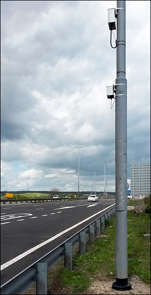
Following an 18-month evaluation of the technology, Portsmouth, a city of 855,000 on the southern coast of the United Kingdom, has installed five BlipTrack sensors along key routes throughout the city. “The journey time is the key part of the data for us,” says Less Gilbert, an assistant traffic engineer for Portsmouth City Council, “providing physical proof that travel times into or out of the city are reasonable or not—especially during major [roadwork], large-scale events or serious incidents on the [road] network.”

Road engineers analyze the collected data to help pinpoint the source of congestion. They then experiment with changes to infrastructure, such as the addition or removal of traffic lights at key intersections, in order to smooth traffic flow. The engineers watch the journey time data especially closely after they add a traffic light, Gilbert adds, to make sure it does not cause unexpectedly slow sections on the roads.
Christian Carstens, BLIP Systems’ marketing manager, says the BlipTrack software filters the smartphone Bluetooth radio signals coming from outliers, such as vehicles stopping on the route, bicycles or pedestrians. It does this by determining what a “normal” driving time is for vehicle traffic, based on aggregating the speed with which devices along a particular route are moving. “The normal driving time will vary during the day, depending on the traffic,” he says.
Eventually, Portsmouth might add real-time travel times between key points in Portsmouth, based on the BLIP Systems data, to its live traffic webpage, which also includes video feeds from cameras mounted on two sections of M275, the main highway that serves Portsmouth.
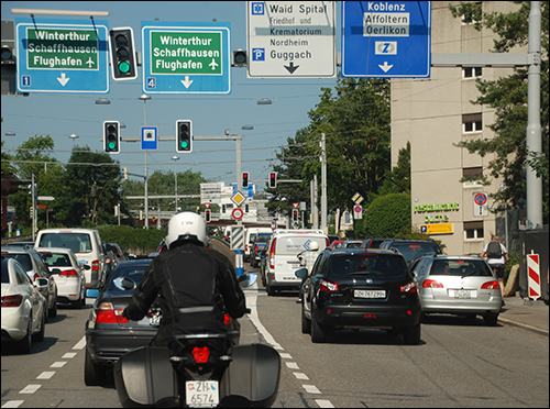
Zurich, Switzerland’s largest city, is two years into a five-year evaluation period, during which it is testing more than 80 BlipTrack sensors to measure real-time travel times and analyze road traffic on 50 main routes. In the city, rapid growth is putting pressure on the city’s transportation infrastructure.
Susanne Roggendorf, a principal with DTV-Verkehsconsult, the company that installed the technology, says that before deciding to pilot the BlipTrack sensors, her firm evaluated systems that use cameras in conjunction with automatic number [license] plate recognition (ANPR) software. But the higher cost of that technology, compared with the Bluetooth sensors and accompanying software, as well as the privacy concerns associated with collecting license plate numbers, led to the decision to use BLIP Systems.
The company had already evaluated the use of Bluetooth technology to measure traffic flow, and released a research paper on the topic in 2013. Roggendorf says the BlipTrack sensors’ antenna design and the ability to add a Wi-Fi radio to the sensor unit in the future, as a secondary means of data collection, won them over. (Portsmouth is already using BlipTrack sensors with integrated Wi-Fi receivers.)
The sensors in Zurich are placed into position at a road intersection in a section that the city’s planners want to monitor in order to inform strategic planning decisions. They generally remain in place for one month before being moved to another location. In this way, the city obtains as much data about traffic patterns as possible.
If, in the future, the city decides to place sensors permanently, Roggendorf says, it could use the data in a smartphone app that would offer commuters real-time traffic information, and perhaps help them decide between driving, taking public transit, walking or biking.
In Denmark, the Port of Aalborg uses BLIP Systems technology to track traffic flow as part of a traffic-management and safety program. BlipTrack sensors are also employed at more than 25 airports around the world (including the Cincinnati Northern Kentucky International Airport), where they are used to calculate expected wait times—at security gates, for example—based on how many travelers are standing in line at any given time.