Farmers need real-time crop insights so they can monitor crop health and maintain vitality of the crops and prevent crop loss.
Delayed inspections can cause significant yield loss. Some pest outbreaks require treatment within 48 to 72 hours; missing this window leads to crop loss. With that said, the United Nations (2021) mentioned that a 40 percent loss of crop due to pest infestation costs the economy more than $220 billion annually.
The demand for real-time crop insights also addresses agriculture’s labor shortage. About 56% of U.S. farmers have reported labor shortages.This lack of workers delays inspections, contributing to crop loss from poor health checks.
The Data Gap in Traditional Crop Monitoring
There is a data gap in traditional crop monitoring, and this includes limited frequent monitoring and crop spatial blind spots. Manual field scouting, stationary sensors, and periodic satellite imagery are the common standard methods of traditional crop monitoring.

A manual field scout covers limited sections of a 500-acre farm daily, allowing anomalies in some areas to go unnoticed. This results in undetected diseases and missing early-stage issues in a fraction of a large crop caused by spatial blind spots.
This fragmented data limits the integration of a single location-specific view due to its independent operation monitoring. In effect, it causes delayed insights and not up-to-date data, determining the effectiveness and timely prevention.
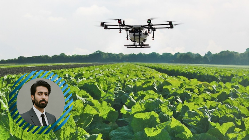
How Drones Enable Large-Scale, Real-Time Field Observation
Drones enable large-scale, real-time field observation by bringing an entirely new outlook on field monitoring using precision agriculture drones. It offers a fast and high-resolution aerial perspective. For instance, a drone can survey 1,000 acres within hours, while a ground-based team would require several days.
The drone surveillance of the croplands through unmanned aerial vehicle (UAVs) has come into play primarily because these aerial vehicles have various applications. Drones are equipped with multispectral and thermal sensors measuring Normalized Difference Vegetation Index (NDVI), showing vegetation health through near-infrared light.
An article by Bashar Alsadik et al. (2024) indicates that UAVs can detect water stress and nitrogen deficiencies days before physical symptoms. The quick and repeatable collection cycle offers the “where” and “when” of field conditions across large areas.
How RFID Adds Identity and Precision to Crop Data
RFID adds identity and precision to crop data by providing an aerial view which shows the identity from the ground. RFID depends on radio frequencies for tracking of tags attached to objects.
With regard to agriculture, RFID tags have been applied to animals, plants, and health monitoring. These tags are often very unobtrusive and placed on single plants, saplings, or soil-moisture probes.
The use of Ultra-High Frequency (UHF) RFID tags in agriculture provides precision and read ranges of up to 10-12 meters. Their ability to be read through any obstacle and environmental challenges, like mud and rain, has made them advantageous over barcodes.
By giving a specific micro-zone a unique digital ID, location-specific crop insights become possible, thus enabling accurate tracking of plant cycles.
How Integrating Drones with RFID Creates Real-Time Crop Insights
Integrating drones with RFID creates real-time insights by connecting aerial vision with the identification at the ground level. The main innovation is the drone being treated as a proper mobile RFID reader.
In applied deployments, this integration workflow is often implemented through a specialized agriculture drone service that manages UAV flight operations, RFID data capture, and synchronization with farm management systems.
The Integration Workflow:
- Synchronization: The RFID reader “pings” the ground tags as the drone flies over a section of the field.
- Data Coupling: The aerial imagery and the unique ID of the tag underneath are captured by the system at the same time.
- Localization: The drone’s GPS onboard timestamps and geo-locates the particular tag interaction.
- Real-Time Processing: Integration data is sent to the farm management system, where aerial health data is linked to the specific plant RFID.
This automated field data collection eliminates manual entry of data while ensuring the aerial data is related to an identifiable place
Types of Crop Insights Enabled by Drone-RFID Integration
Together, these two technologies can enable more granular, location-specific crop insights:
Micro-Zone Stress Profiling: Crop insights specific to a particular tag’s area can pinpoint the exact rows that require treatment.
Precise Growth Tracking: By associating plant height with specific plant RFIDs over time, drones can help track the precise growth curves for various seed types.
Early Pathogen Mapping: UAV-based field monitoring can indicate a decrease in NDVI. The system then checks the RFID-tagged location’s history to identify the cause.
How These Insights Improve Farming Decisions and Outcomes
Knowing the exact underperforming zones, farmers can use Variable Rate Application (VRA). Instead of blanket spraying, farmers will use the drone with RFID technology to limit application to specific zones.
According to Chen (2025), precision agriculture with drones and IoT can lead to waste reduction by 40-60% and yield gains of 20-30%. Moreover, the intervention is significantly quicker when real-time crop monitoring is in place.
A report by Schimmelpfennig (2018) proves precision can increase Resource Use Efficiency (RUE) by 15-20% in high-value specialty crops. Hence, it becomes clear that crop data accuracy is the most treasured asset among today’s growers.
Real-World Applications of Drone-RFID Smart Fields
The adoption of this technology from the lab to the real world is now developing. A study by Orlandi et al. (2025) allowed continuous maintenance of grape quality through RFID-enabled agriculture and drone surveys.
A case by Patiluna et al. (2023) cited precision agriculture drones reading the RFID tags on seedlings, producing an instant inventory. The drones are working at a height of 3 meters and reading the tags with a 90% mark of certainty. The technique has cut down the manual handling time by 90% when compared with the conventional methods (Patiluna et al., 2024).
The pilot projects prove the integration of IoT in agriculture is not a matter of the future but, instead, today’s advantage. It empowers the cultivation of environmentally friendly and resource-efficient farming models.
Challenges in Achieving Real-Time Insights Through Integration
There are challenges in achieving real-time insights through integration which includes the following:
- Restrictions in Battery Life and Payload: The use of an imaging device together with a powerful RFID reader considerably cuts down on the operating time.
- Signal Interference: RFID signals can be obstructed by large trees or the presence of humidity, thus causing the tags to be “missed”.
- Data Complexity: Data collected and produced requires sensor-based farming systems and virtually total bandwidth.
- Regulatory Obstacles: Some places still restrict drone flights, which could limit the monitoring of extensive areas or isolated fields.
The Future of Smart Fields and Real-Time Agriculture
Current research directions suggest incremental movement toward higher levels of automation in field monitoring. Future advancements will probably include the use of artificial intelligence for real-time analysis, performing data analysis above.
The agricultural IoT integration is mostly from small drone users working together, with one detecting issues while another applies resources locally. The availability of 5G deployment in rural areas reduces the time lag between detection and response of data-driven farming decisions.
The combination of drones with RFID technology represents a measurable change in how field data can be collected and applied at finer spatial scales. The use of UAVs covering vast areas and exact RFID identification bridges the gap of traditional farming.
This convergence of technologies offers a resolution of the problem in high definition that will lead to better choices. The industry will be forced to deal with both the challenges of sustainability and productivity. In addition, the ability to quickly produce valuable information through technology integration marks a successful adaptation to market changes.