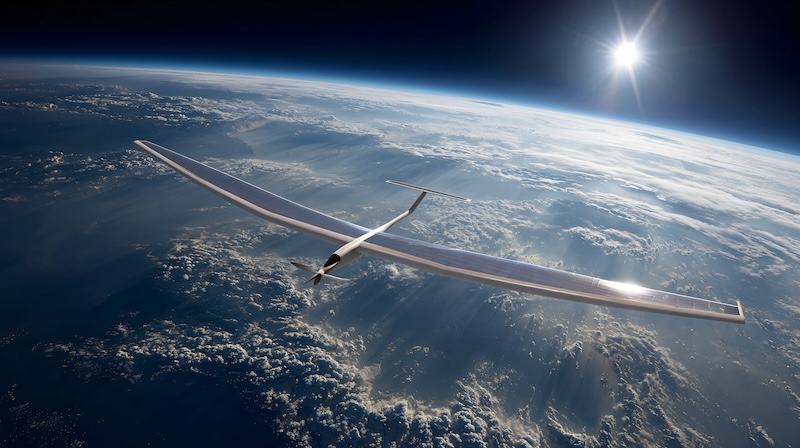
When most people hear about high-altitude platforms (HAPs), they think of intelligence, surveillance, and reconnaissance.
And for good reason: defense investment and headlines have long revolved around intelligence, surveillance, and reconnaissance (ISR’s) value to national security. The military UAV market itself is projected to grow from roughly $15.2–15.8 billion in 2024–2025 to nearly $22.8 billion by 2030. That scale explains why ISR dominates conversations around high-altitude, long-endurance (HALE) aircraft.
However, this single-lens view leaves a broader opportunity overlooked. Advances in modular payloads, energy efficiency, and autonomous operation are positioning HAPs as next-level tools for fields ranging from disaster response and telecom connectivity to climate research and commercial monitoring. In other words, the “satellite versus drone” conversation is incomplete without acknowledging the space in between. Let’s talk about it.
Connectivity from the Stratosphere
In underserved regions, high-altitude platforms can function as quasi-satellites, providing cellular and broadband coverage at a fraction of satellite cost. Telecom providers are already experimenting with balloon- and UAV-based systems to extend connectivity to rural and remote populations.

Because HAPs fly above commercial air traffic but below orbit, they offer persistence and flexibility. Unlike satellites, they can be repositioned quickly. Unlike ground towers, they cover vast geographies without dense infrastructure.
As demand for low-latency and resilient networks rises, especially with 5G and eventually 6G, HAPs may become a cost-effective complement to space-based constellations.
Rapid Disaster Response
After earthquakes, hurricanes, or wildfires, communication infrastructure is often the first system to fail, precisely when responders and communities need it most. High-altitude UAVs can restore coverage or provide situational awareness within hours rather than the days or weeks it takes to rebuild ground networks or deploy satellites.
Past disasters illustrate the stakes. During the 2010 Haiti earthquake, the collapse of cellular and broadcast systems severely hampered rescue coordination. More recently, California’s wildfire seasons have shown the life-saving role of aerial monitoring in tracking fire spread and guiding evacuations.
What makes high-altitude platforms different is their adaptability. A UAV configured for telecom payloads to re-establish cellular coverage could, within a day, be equipped with infrared sensors to map hotspots or with high-resolution cameras to survey flood damage. Unlike satellites, which are locked into fixed payloads, or manned aircraft, which are limited by crew endurance and cost, HAPs offer a persistent, reconfigurable layer of support.
For emergency management agencies, humanitarian organizations, and local governments, this means access to a flexible asset that can scale across different disaster types. Beyond restoring communications, HAPs can help identify damaged infrastructure, monitor population movement, and even provide early warning when disaster risk escalates, all from the vantage point of the stratosphere.
Climate and Atmospheric Research
Satellites and ground stations have long provided data for climate science, but high-altitude platforms offer something new: sustained, localized observation with greater control.
Researchers studying atmospheric chemistry, greenhouse gas emissions, or severe weather can benefit from HAPs’ ability to loiter over a fixed area for weeks at a time. Projects such as NASA’s ER-2 high-altitude research aircraft demonstrate the scientific hunger for extended atmospheric monitoring.
Through the use of specialized sensors (lidar, spectrometers, or particle samplers), HAPs could democratize this capability, expanding access to universities and research institutions without satellite-level budgets.
Commercial Monitoring and Industry Use Cases
Beyond defense and science, there is a growing commercial appetite for persistent monitoring of infrastructure, agriculture, and natural resources. Companies are under pressure to reduce risk, cut costs, and meet stricter regulatory requirements. These are all conditions that make continuous aerial oversight highly valuable.
Energy operators, for example, could use high-altitude platforms to monitor offshore rigs or remote pipelines for leaks, corrosion, or security breaches, reducing reliance on costly crewed flights. In agriculture, HAPs could track crop health, soil moisture, and irrigation trends across thousands of acres in near real time, supporting precision-farming practices that improve yields and reduce waste.
Because high-altitude UAVs can stay aloft for weeks at a time, they help solve the “revisit time” challenge of satellites, which may only pass over a location once every few days. Their modular design also allows payloads to be swapped based on seasonal or operational needs. This could be a multispectral camera for crop analysis during the growing season or a methane sensor for energy-sector monitoring in colder months.
Such flexibility opens the door for new data-as-a-service models. Insurance providers could use HAP-collected imagery to assess claims after storms. Mining companies could track environmental compliance at remote sites. Logistics firms could gain visibility into shipping lanes and port activity.
Together, these applications point to a commercial future where high-altitude platforms function as shared infrastructure, delivering valuable data streams across multiple industries.
A Bridge Between Domains
The overlooked story of high-altitude platforms is that they function as a bridge between traditional aerospace categories:
- Between satellites and terrestrial towers for connectivity.
- Between manned aviation and ground response for disaster relief.
- Between space research and field stations for climate science.
The flexibility comes from payload modularity and endurance—allowing a single airframe to serve multiple missions across defense, science, and commercial markets. The broader the adoption, the more cost can be shared across domains, accelerating innovation.
The HAP Conversation Is Just Beginning
As aerospace and defense stakeholders look toward the next decade, it’s worth expanding the lens on HAPs. They are not replacements for satellites, nor competitors to manned aircraft, but a complementary layer with distinct advantages. For policymakers, this means rethinking regulatory frameworks that often pigeonhole UAVs into narrow categories. For industry, it means exploring partnerships across telecom, climate science, and emergency management rather than focusing solely on defense.
And for the public, it means recognizing that the same platforms monitoring battlefields could one day help restore cell service after a hurricane or provide data to predict climate-driven flooding.
The conversation around high-altitude platforms shouldn’t end with ISR. In fact, that’s only where it begins.